










Executive Overview
Across the globe, more than half a billion people reside in low-lying coastal zones, anchoring their livelihoods, economies, and futures to the fragile boundary where land meets sea. For decades, the global narrative surrounding coastal vulnerability has focused almost exclusively on the oceans: melting polar ice caps, thermal expansion, and accelerating sea level rise driven by anthropogenic climate change. However, a groundbreaking global study published in Nature Communications reveals a stark, compounding crisis that shifts the paradigm of coastal threat assessments.
The research—conducted by an international team from the German Geodetic Research Institute at the Technical University of Munich (DGFI-TUM) and Tulane University in New Orleans—demonstrates that coastal communities are being squeezed from two directions simultaneously. While oceans are rising due to climate change, the ground beneath many of the world’s most densely populated urban centers is actively sinking.
This dual-threat phenomenon means that millions of urban residents are experiencing a relative sea level rise that far outpaces global climate projections. According to the study, individuals living in heavily populated coastal regions face an average relative sea level rise of approximately 6 millimeters per year. This figure is nearly three times the coastline-weighted global average of 2.1 millimeters per year and almost twice the climate-driven absolute sea level rise of roughly 3.15 millimeters per year.
The primary driver of this discrepancy is land subsidence—the gradual or rapid downward movement of the Earth’s surface. Driven by a volatile mix of human activities and natural geological processes, subsidence turns localized coastal flooding into an immediate, high-velocity emergency. While global climate mitigation strategies require decades to alter oceanic trends, land subsidence is heavily influenced by localized human actions, offering both an urgent warning and a tangible pathway for intervention.
Detailed Chronology: Uncovering the Dual Threat of Sinking Coasts
The realization that coastal sinking is drastically compounding climate-driven sea level rise is the culmination of years of advanced geodetic monitoring, satellite altimetry, and geological analysis. Understanding how researchers arrived at these alarming conclusions requires examining the trajectory of how we measure sea level change.
From Global Ocean Modeling to Localized Realities
Historically, scientists assessed sea level rise by observing the oceans through tide gauges and satellite altimeters. These instruments provided a macro-level view of absolute sea level rise—the physical increase in the volume of the world’s oceans. For decades, this metric hovered around 3.15 millimeters per year, serving as the benchmark for international climate policy and coastal defense planning.
However, this metric operated on a critical blind spot: it assumed a static, unmoving land surface. Along heavily populated coastlines, the ground is rarely static. Recognizing this gap, researchers at DGFI-TUM and Tulane University combined high-resolution satellite radar interferometry (InSAR), continuous GPS tracking, and global hydrological modeling to isolate vertical land motion from absolute sea level rise.
When the research team integrated these datasets on a global scale, a dramatic geographical mismatch emerged. The relative sea level rise—what people living on the coast actually experience as water encroaches on their doorsteps—was vastly higher in urban centers than general oceanographic models predicted. By publishing their findings in Nature Communications, the research consortium fundamentally shifted the scientific consensus: coastal vulnerability cannot be understood by monitoring the oceans alone; the land itself must be watched.
The Accelerating Timeline of Urban Sinking
The historical roots of human-induced subsidence stretch back to the industrial revolution, when rapidly expanding coastal cities began tapping deep underground aquifers to fuel their growth. Throughout the 20th century, cities like Tokyo, Jakarta, and Houston experienced unprecedented drops in ground elevation.
In the mid-to-late 20th century, extreme subsidence made headlines in specific metropolitan areas, but these events were largely treated as localized engineering challenges rather than symptoms of a global systemic crisis. Tokyo, for instance, witnessed land sinking by more than 10 centimeters per year, with hyper-localized hot spots dropping by a staggering 24 centimeters annually.
It was not until the advent of modern geodetic satellites in the 21st century that scientists could quantify the scale of subsidence on a planetary level. The recent study by Dr. Julius Oelsmann and Professor Florian Seitz marks a definitive turning point in this chronology. By aggregating population data with vertical land motion metrics, the team established a "population-weighted coastal average," proving that the human toll of relative sea level rise is disproportionately concentrated in fast-sinking urban deltas across the Global South and industrialized world alike.
Supporting Context & Metrics: The Anatomy of Land Subsidence
To comprehend the severity of the crisis, one must analyze the complex mechanics of how and why coastal land sinks, alongside the specific quantitative metrics identified by the TUM and Tulane University researchers.
The Multi-Faceted Causes of Subsidence
The downward movement of coastal land is rarely attributable to a single cause. Instead, it is typically the result of multiple compounding forces operating simultaneously across geological and anthropogenic scales.
- Anthropogenic Groundwater Pumping: The single most influential human driver of subsidence is the excessive extraction of groundwater. As expanding coastal populations and industrial sectors pump water out of subsurface aquifers faster than natural rainfall can replenish them, the water pressure that once supported the weight of the overlying strata is lost. The microscopic pores within clay, silt, and sand layers collapse permanently, causing the ground surface to sink.
- Oil, Gas, and Mineral Extraction: Similar to groundwater pumping, the extraction of hydrocarbons and fluids from deep geological formations removes subsurface structural support, triggering rapid surface depression, particularly in deltaic and coastal oil-patch regions.
- Sediment Compaction in River Deltas: Natural geological processes also play a major role. Major coastal cities are frequently built on young, unconsolidated river deltas. Over time, the heavy weight of these sediment deposits naturally compacts the underlying layers under the force of gravity.
- Urban Weight (Infrastructure Load): The sheer structural mass of modern megacities—composed of millions of tons of concrete, steel, and asphalt—exerts immense pressure on soft, pliable deltaic soils, accelerating local compaction.
- Tectonic and Postglacial Adjustments: Natural tectonic movements and long-term adjustments in the Earth’s crust following the melting of ancient ice sheets from the last Ice Age (glacial isostatic adjustment) cause regional variations, with some areas sinking while others experience tectonic uplift.
Global Metrics and Hot Spot Analysis
The data compiled by the research team categorizes the severity of relative sea level rise across nations and specific urban centers, revealing stark global disparities.
- High-Risk Nations: Countries in the developing world and rapidly industrializing regions bear the heaviest burden. Thailand, Bangladesh, Nigeria, Egypt, China, and Indonesia record the highest relative sea level rises globally, with population-weighted coastal averages ranging from 7 to 10 millimeters per year.
- Developed Nations: Wealthier nations are not immune. The United States, the Netherlands, and Italy exhibit elevated population-weighted coastal averages of approximately 4 to 5 millimeters per year.
- Subsidence Hot Spots (City-Level Averages):
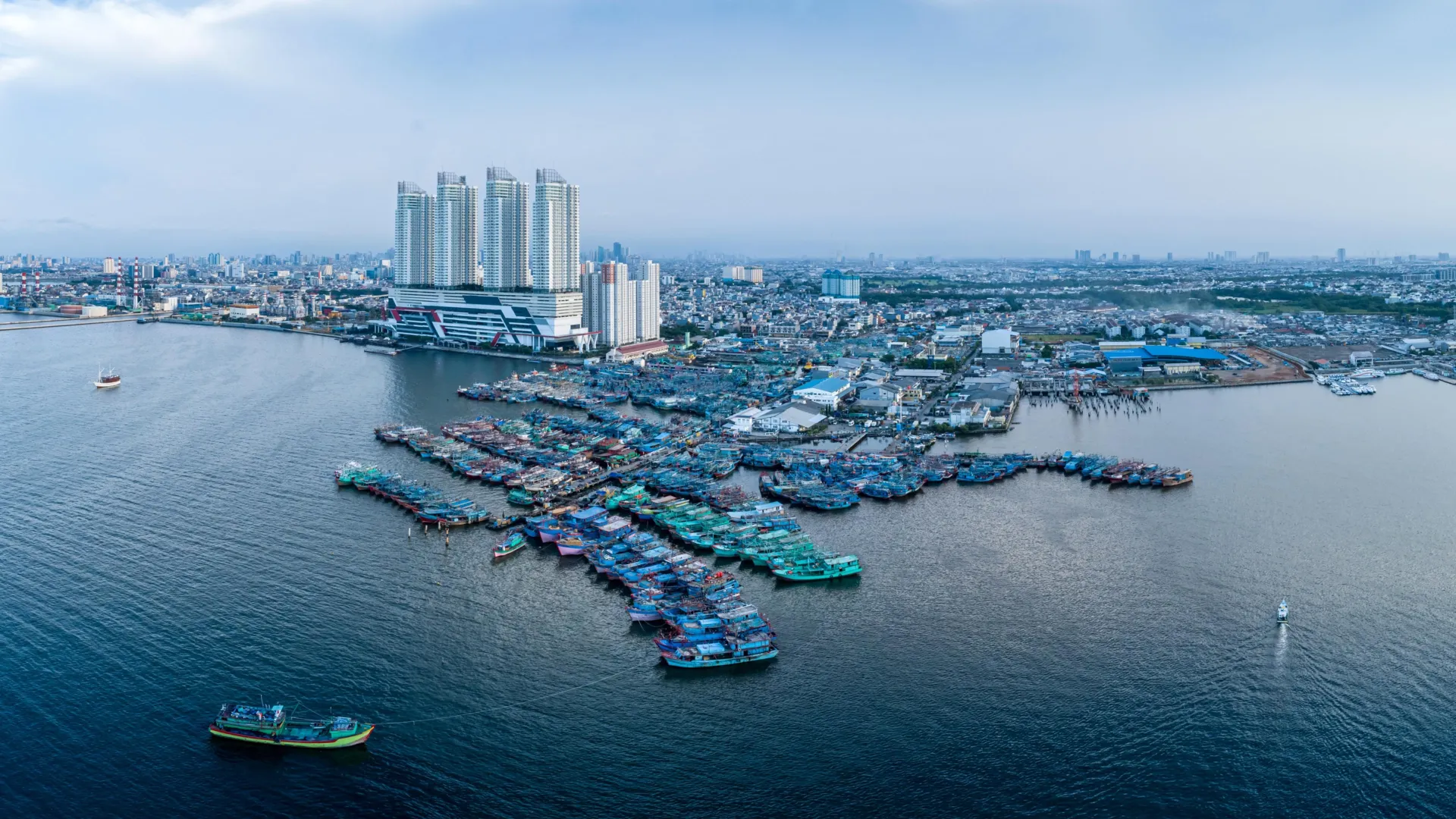
- Jakarta, Indonesia: 13.7 mm/year (with hyper-local zones dropping up to 42 mm/year)
- Tianjin, China: 13.5 mm/year
- Bangkok, Thailand: 8.5 mm/year
- Lagos, Nigeria: 6.7 mm/year
- Alexandria, Egypt: 4 mm/year
Within individual cities, the spatial distribution of subsidence can be wildly uneven. In Jakarta, for instance, infrastructure development and groundwater depletion vary so drastically across neighborhoods that while some areas are sinking at a catastrophic 42 millimeters per year, other adjacent sections are actually experiencing minor relative uplift due to localized engineering or geological variances.
The Counter-Example: Geological Uplift
Crucially, not all coastlines are moving downward. In regions shaped by strong postglacial rebound, such as Sweden and Finland, the land is still rising faster than the global sea level is increasing. This geological uplift produces a relative decline in sea level along parts of the Scandinavian coast, proving that vertical land motion is a bidirectional variable that can either mask or violently amplify climate change impacts.
Official Statements & Expert Insights
The findings from the TUM and Tulane University collaboration have prompted urgent calls for a paradigm shift in how urban planners, hydrologists, and policy-makers approach coastal defense.
Dr. Julius Oelsmann, lead author of the study and a researcher at DGFI-TUM, emphasizes the absolute necessity of looking beyond oceanographic data:
"If we want to understand sea-level rise along coastlines and respond effectively, we must not only observe the ocean but also the land itself. Especially in densely populated coastal regions, human activities cause the land to subside more strongly—often due to excessive extraction of water and resources that previously stabilized the subsurface. The sheer weight of cities, along with long-term geological processes, can further intensify this subsidence. In doing so, we significantly amplify the effects of climate-driven sea-level rise."
Complementing this perspective, Professor Florian Seitz, Chair of Geodetic Geodynamics and Director of DGFI-TUM, highlights that unlike the melting of polar ice caps—which requires global decarbonization to address—subsidence driven by resource extraction can be directly managed and mitigated through local political will:
"In many large coastal cities, groundwater extraction is a major driver of land subsidence. This means that local political and water-management decisions can make a significant difference. Improved groundwater management, stricter regulation of withdrawals, or targeted recharge of aquifers can at least slow subsidence rates and, in some cases, largely halt them."
Future Outlook: Mitigation, Policy, and Survival
The revelation that land subsidence is tripling the effective rate of sea level rise for millions of urban residents paints a sobering picture of the future, but it also provides a roadmap for survival. Because a substantial portion of coastal sinking is anthropogenic, driven by water extraction and resource exploitation, targeted governance can alter the trajectory of vulnerable megacities.
Lessons from Tokyo and Houston
History offers proven templates for halting or drastically reducing land subsidence through aggressive regulatory intervention.
- Tokyo, Japan: During the mid-20th century, Tokyo was a prime example of runaway subsidence, with groundwater extraction causing parts of the city to sink by more than 10 centimeters annually, and extreme hot spots dropping by 24 centimeters a year. Through rigorous government legislation, strict caps on industrial groundwater pumping, and the development of alternative municipal water supplies, Tokyo successfully curtailed groundwater extraction. The result was a dramatic stabilization of the ground, proving that engineered policy can arrest urban sinking.
- Harris-Galveston Region, Texas: Facing severe land subsidence and catastrophic vulnerability to storm surges, local officials in Texas established the Harris-Galveston Subsidence District in 1975. By regulating groundwater withdrawals, mandating alternative surface water sources, and enforcing stringent conservation protocols, the district successfully slowed and in many areas halted the downward movement of the land.
The Path Forward for Modern Megacities
For sinking megacities like Jakarta, Bangkok, Tianjin, and Lagos, the lessons of Tokyo and Houston must be adapted to 21st-century realities. Future coastal adaptation frameworks must integrate three essential pillars:
- Subsurface Governance: Municipalities must enforce strict moratoria on unmonitored deep-aquifer pumping, transition to surface water networks or desalinated water supplies, and invest in artificial aquifer recharge projects that inject treated stormwater back into depleted underground geological layers.
- Integrated Geodetic Monitoring: Coastal urban planners must utilize continuous InSAR satellite tracking and high-precision GPS networks to monitor vertical land motion in real time, identifying sinking hot spots before structural failures and catastrophic flooding occur.
- Adaptive Infrastructure: Engineering standards in coastal zones must account for combined relative sea level rise. Traditional seawalls designed solely for oceanic rise will fail if the land behind them is dropping by 10 to 40 millimeters every year. Foundations must be engineered to withstand dynamic shifts in soil compaction, and urban zoning laws must restrict heavy industrial development in highly vulnerable deltaic basins.
Conclusion
The global coastal crisis is no longer waiting on the distant horizon; it is unfolding beneath our feet. As the research from the Technical University of Munich and Tulane University underscores, the collision between rising seas and sinking land has created an accelerated emergency for over half a billion people.
Yet, within this alarming diagnosis lies a powerful agency. While humanity must continue the arduous global battle against climate change to curb absolute sea level rise, local leaders possess the immediate tools to stop the ground from sinking beneath them. By reforming water management, regulating industrial extraction, and treating land subsidence as an urgent public safety priority, vulnerable coastal cities can buy critical time, protect their populations, and secure a resilient future against the encroaching tides.